Infrastructure
The California we know today, with a population of nearly 40 million people and agricultural land covering millions of acres, would not be possible without major investments in human-engineered infrastructure projects that transport water and power throughout the state and reduce flood risk. Investing in resilient watersheds and ecosystems, or our “green infrastructure,” is just as important to the sustainability of our water supplies and flood management as the concrete structures that move water throughout the state.

Water Delivery Infrastructure
The State Water Project (SWP), developed in the 1960s, is the largest state-built, multi-benefit water delivery system in the United States. Because California receives most of its precipitation in the watersheds of the northern Sierra Nevada mountains, the SWP was designed and built to collect some of that water abundance in the north and distribute it to more arid parts of the state.
The SWP is a complex system of 36 storage facilities, 26 dams, 21 pumping plants, five hydroelectric power plants, four pumping-generating plants, and approximately 700 miles of canals, tunnels, and pipelines engineered to safely store and deliver water. Moving millions of acre-feet of water across our great state requires pumping plants that use significant amounts of power. In fact, the SWP is the largest consumer of electricity in California, but also the 4th largest producer of clean, emission-free hydroelectricity. The Edmonston Pumping Plant, south of Bakersfield, is the world’s tallest water lift, pumping water 1,926 feet up and over the Tehachapi Mountains into Southern California.
In addition to supplying water to 27 million Californians and 750,000 acres of farmland, the SWP provides flood management benefits, recreational opportunities, and water for fish and wildlife. Learn more about how California’s water supply and delivery system works.

Nature’s Water Infrastructure
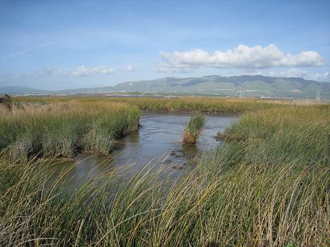
The benefits of our “gray infrastructure” depend on the health of California’s “green infrastructure,” namely our watersheds and the ecosystems therein. A watershed is an area of land that catches and channels rainfall and snow melt into creeks, streams, and rivers, and eventually to reservoirs, bays, the ocean, or underground aquifers. Watersheds are an integral part of California’s water system. As climate change advances, watersheds are even more important to the reliability, quantity, and quality of California’s water supplies. Investing in green infrastructure projects like ecosystem restoration is a cost-effective way to protect and maintain healthy watersheds in California. Also, tidal and floodplain restoration projects are important strategies to reduce flood risk.
Integration
DWR takes a science-driven approach to integrate water delivery infrastructure projects with watershed restoration projects to support the long-term vitality of California’s thriving economy, communities, and ecosystems. Resilient watersheds are the foundation of water resource sustainability. The integrated management of our natural and engineered water systems ensures that we can provide clean water, protect habitats, prevent flooding, reduce pollution, and create recreational opportunities long into the fut
ure.
Green Infrastructure Projects
DWR utilizes the latest science and technology in developing green infrastructure projects such as:
- North Delta Flood Control and Ecosystem Restoration Project
- Dutch Slough – Tidal Marsh Restoration Project
- Fremont Weir Adult Fish Passage Modification Project
- Lookout Slough – Tidal Habitat Restoration Project
- Mendonca Dairy Floodplain Restoration Project
- Southport Levee Setback Project
- Wallace Weir Fish Rescue Facility Project
- Yolo Bypass Salmonid Habitat and Restoration Fish Passage Project
- Lower Putah Creek Restoration Project
- McCormick Williamson Tract – Floodplain and Tidal Habitat Restoration Project
- Decker Island – Tidal Habitat Restoration Project
- Winter Island – Tidal Habitat Restoration Project
- Yolo Flyaway Farms – Tidal Habitat Restoration Project
- Robinson Reach – Merced River gravel pit isolation and floodplain restoration
- Bullock Bend Floodplain and salmonid floodplain restoration
- Dos Rios Floodplain Restoration Project
- Lower Carmel River Floodplain/Tidal Estuary Restoration
- Budiselich Dam removal and fish passage restoration
- San Clemente Dam removal & fish passage restoration project
- Whales Mouth Wetland Restoration
- Mayberry Farms Wetland Restoration and Carbon Sequestration Project
- Sherman Island Setback Levee
- Prospect Island Tidal Habitat Restoration Project
- Lower Elkhorn Basin Levee Setback Project
Floodplains, forested land, and other restored sites can:
- Improve soil and water quality
- Sequester carbon and filter pollutants in the air and water
- Prevent or reduce erosion
- Reduce summer air and water temperatures
- Improve regional air quality
- Reduce stormwater runoff and flooding
- Recharge groundwater
- Reduce fire risks and damage
