Flood-Managed Aquifer Recharge (Flood-MAR)
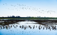
“Flood-MAR” is an integrated and voluntary resource management strategy that uses flood water resulting from, or in anticipation of, rainfall or snow melt for managed aquifer recharge (MAR) on agricultural lands and working landscapes, including but not limited to refuges, floodplains, and flood bypasses. Flood-MAR can be implemented at multiple scales, from individual landowners diverting flood water with existing infrastructure, to using extensive detention/recharge areas and modernizing flood management infrastructure/operations.
Flood-MAR projects can provide broad benefits for Californians and the ecosystems of the state, including:
- Water supply reliability
- Flood risk reduction
- Drought Preparedness
- Aquifer Replenishment
- Ecosystem Enhancement
- Subsidence Mitigation
- Water Quality Improvement
- Working Landscape
Preservation and Stewardship - Climate Change Adaptation
- Recreation and Aesthetics
There is strong, and growing, interest across the state in understanding the benefits, limitations, concerns, costs, and funding opportunities for Flood-MAR projects. DWR plans to work with other state, federal, tribal, and local entities; academia; and landowners. Together, we will build on the knowledge and lessons from past and ongoing studies and programs, pursue expanded implementation of Flood-MAR, and make Flood-MAR an integral part of California’s water portfolio.
DWR has been working with partners to develop a systematic approach to identify floodplain restoration and expansion opportunities that provide high-quality salmonid habitat and enhance naturally occurring floodplain recharge. The Ecological Floodplain Inundation Potential (EcoFIP) toolkit facilitates the identification, analysis, and prioritization of multiple floodplain restoration opportunities at the reach or project scale. The pilot study tools help visualize and compare conceptual restoration designs for potential habitat and recharge benefits and quantify potential benefits and implementation costs. For more information, check out the StoryMaps linked below:
Multiple Benefit Floodplain Restoration Pilot Studies Overview
Upper San Joaquin Study Phase I
Merced River Watershed Flood-MAR Reconnaissance Study
To better understand climate vulnerabilities and how to address them, the California Department of Water Resources (DWR) conducted a three-year Merced study in partnership with Merced Irrigation District (MID) as a proof of concept to explore the effectiveness of Flood-MAR to concurrently reduce flood risk, improve water supply, and enhance ecosystems in the Merced River watershed, a tributary to the San Joaquin River. The Merced study is an exploratory watershed-scale analysis to develop and test analytical methods and models, assess climate change vulnerability, and evaluate adaptation strategies meeting multiple benefits that achieve these shared objectives:
- Assess watershed vulnerability to climate change for flood protection, water supply, and ecosystems.
- Develop Flood-MAR strategies reflecting a range of operational complexity and infrastructure improvements.
- Quantitatively evaluate the performance of Flood-MAR strategies in providing multi-sector benefits and climate resilience.
Following is the Merced River Watershed Flood-MAR Reconnaissance Study Report and supporting technical information records (TIR) that explain the development as well as the results of the study:
- Merced River Watershed Flood-MAR Reconnaissance Study Report
- TIR 1 Plan of Study
- TIR 2 Model Integration
- TIR 3 Climate Change Vulnerability Assessment and Baseline Assumptions
- TIR 4 Adaptation Strategy Performance
Coordinating Flood and Groundwater Management Brochure
The California Department of Water Resources (DWR) prepared this brochure to describe opportunities that improve use of floodwater for managed aquifer recharge (Flood-MAR) to reduce flood risk, increase groundwater recharge, adapt to climate change, and provide other benefits. Recent cycles of drought and flood provide an enhanced opportunity to strengthen the nexus between the flood management and groundwater management communities. Developing a resilient flood system will require decision-making that not only manages the surface water, but also the dynamic interchange of surface water and groundwater horizontally across floodplains and vertically through the subsurface.

The California Department of Water Resources (DWR) prepared this white paper to explore opportunities to use flood water for managed aquifer recharge (Flood-MAR) because DWR recognizes the need to rehabilitate and modernize water and flood infrastructure in California. Large-scale implementation of Flood-MAR can fundamentally change how flood and groundwater management are integrated by using flood water resulting from, or in anticipation of, rainfall or snowmelt for groundwater recharge on agricultural lands and working landscapes, including but not limited to refuges, floodplains, and flood bypasses.

Flood-MAR Research and Data Development Plan Evaluation
In the years since the R&DD Plan’s development, much progress has been made toward advancing more widespread adoption of Flood-MAR. This evaluation details the results of a qualitative analysis to better understand progress towards the 39 priority actions. This evaluation also includes references to about 50 resources that have been developed by state and non-state entities to support the widespread adoption and implementation of Flood-MAR.

Flood-MAR Research and Data Development Plan
This Flood-MAR Research and Data Development Plan (R&DD Plan) presents the work of the Flood-MAR Research Advisory Committee (RAC), a multidisciplinary group of subject matter experts across 13 research themes. The RAC was tasked to identify the research, data, guidance, and tools necessary to support and expand the implementation of Flood-MAR projects. Well-formulated Flood-MAR projects can benefit Californians and the environment through improved water supply reliability, flood-risk reduction, drought preparedness, aquifer replenishment, ecosystem enhancement, subsidence mitigation, water quality improvement, working landscape preservation and stewardship, climate change adaptation, recreation, and aesthetics.
- Appendix 1: Hydrology Observation and Protection
- Appendix 2: Reservoir Operations
- Appendix 3: Infrastructure Conveyance and Hydraulics
- Appendix 4: Crop Systems Suitability
- Appendix 5: Soils Geology and Aquifer Characterization
- Appendix 6: Land Use Planning and Management
- Appendix 7: Water Quality
- Appendix 8: Recharge and Extraction Methods & Measures
- Appendix 9: Environmental - Terrestrial and Riparian/Aquatic
- Appendix 10: People and Water
- Appendix 11: Economic Analysis
- Appendix 12: Local, State, Federal Policies, and other Legal Considerations
- Appendix 13: Tools and Application Development
The following websites provide additional information and resources on the benefits and issues of using flood waters to recharge groundwater basins.
Contact Us
Supervising Engineer, Water Resources
Division of Statewide Integrated Water Management
Jennifer.Marr@water.ca.gov
Events
Blogs

Face coverings have become vital to our public health during the COVID-19 pandemic. When DWR employee Linda Slavik learned of the overwhelming need for face masks, she took it upon herself to make themed masks and donate them to those that needed them most.

Do you wish you could find hands-on, paid work experience while in school? DWR's Student Assistant Program offers on-the-job training to individuals enrolled in high school, college, or any recognized school of learning.

California’s 2020 legislative session came to an end Sept. 30 with several new bills signed into law that will impact water operations and the Department of Water Resources.

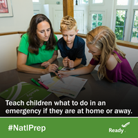
Preparing for a flood disaster starts at home. Disasters can happen everywhere, and every member of the family should be part of the planning, including young children and teens.

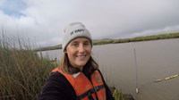
We sat down with Hailey Wright, a Department of Water Resources (DWR) environmental scientist, to discuss the salmon lifecycle and her work designing and implementing projects in the Yolo Bypass to improve habitat and fish passage for native salmonids and sturgeon.

California has the most variable weather conditions in the United States, often varying between extremes such as drought and flood. Our ability to forecast variable weather conditions well in advance is a driving factor in how water managers maximize the benefits and minimize the hazards of each storm.

For National Garden Week (June 7 to 13), DWR Landscape Architect Specialist and native plant enthusiast Cassandra Nguyen Musto explains why you should consider gardening with native plants for your next home landscaping project.

A marshy tract known as Sherman Island is one of the most sensitive and geographically important locations for water conveyance in California. On May 11, DWR began a restoration project on the southeast side of the island that combats climate change while protecting statewide water supply.

Flooding is a major issue across California – every county has experienced a federally declared flood disaster in the past 20 years. To help Californians stay prepared this flood season, DWR is participating in the eighth annual California Flood Preparedness Week from October 19 – 26, 2019.

DWR gathered with its partners and contractors Oct. 15 to celebrate the completion of the 460-acre tidal wetland known as Tule Red in the Suisun Marsh.


