Flood-Managed Aquifer Recharge (Flood-MAR)
“Flood-MAR” is an integrated and voluntary resource management strategy that uses flood water resulting from, or in anticipation of, rainfall or snow melt for managed aquifer recharge (MAR) on agricultural lands and working landscapes, including but not limited to refuges, floodplains, and flood bypasses. Flood-MAR can be implemented at multiple scales, from individual landowners diverting flood water with existing infrastructure, to using extensive detention/recharge areas and modernizing flood management infrastructure/operations.
Flood-MAR projects can provide broad benefits for Californians and the ecosystems of the state, including:
- Water supply reliability
- Flood risk reduction
- Drought Preparedness
- Aquifer Replenishment
- Ecosystem Enhancement
- Subsidence Mitigation
- Water Quality Improvement
- Working Landscape
Preservation and Stewardship - Climate Change Adaptation
- Recreation and Aesthetics
There is strong, and growing, interest across the state in understanding the benefits, limitations, concerns, costs, and funding opportunities for Flood-MAR projects. DWR plans to work with other state, federal, tribal, and local entities; academia; and landowners. Together, we will build on the knowledge and lessons from past and ongoing studies and programs, pursue expanded implementation of Flood-MAR, and make Flood-MAR an integral part of California’s water portfolio.
DWR has been working with partners to develop a systematic approach to identify floodplain restoration and expansion opportunities that provide high-quality salmonid habitat and enhance naturally occurring floodplain recharge. The Ecological Floodplain Inundation Potential (EcoFIP) toolkit facilitates the identification, analysis, and prioritization of multiple floodplain restoration opportunities at the reach or project scale. The pilot study tools help visualize and compare conceptual restoration designs for potential habitat and recharge benefits and quantify potential benefits and implementation costs. For more information, check out the StoryMaps linked below:
Multiple Benefit Floodplain Restoration Pilot Studies Overview
Upper San Joaquin Study Phase I
Merced River Watershed Flood-MAR Reconnaissance Study
To better understand climate vulnerabilities and how to address them, the California Department of Water Resources (DWR) conducted a three-year Merced study in partnership with Merced Irrigation District (MID) as a proof of concept to explore the effectiveness of Flood-MAR to concurrently reduce flood risk, improve water supply, and enhance ecosystems in the Merced River watershed, a tributary to the San Joaquin River. The Merced study is an exploratory watershed-scale analysis to develop and test analytical methods and models, assess climate change vulnerability, and evaluate adaptation strategies meeting multiple benefits that achieve these shared objectives:
- Assess watershed vulnerability to climate change for flood protection, water supply, and ecosystems.
- Develop Flood-MAR strategies reflecting a range of operational complexity and infrastructure improvements.
- Quantitatively evaluate the performance of Flood-MAR strategies in providing multi-sector benefits and climate resilience.
Following is the Merced River Watershed Flood-MAR Reconnaissance Study Report and supporting technical information records (TIR) that explain the development as well as the results of the study:
- Merced River Watershed Flood-MAR Reconnaissance Study Report
- TIR 1 Plan of Study
- TIR 2 Model Integration
- TIR 3 Climate Change Vulnerability Assessment and Baseline Assumptions
- TIR 4 Adaptation Strategy Performance
Coordinating Flood and Groundwater Management Brochure
The California Department of Water Resources (DWR) prepared this brochure to describe opportunities that improve use of floodwater for managed aquifer recharge (Flood-MAR) to reduce flood risk, increase groundwater recharge, adapt to climate change, and provide other benefits. Recent cycles of drought and flood provide an enhanced opportunity to strengthen the nexus between the flood management and groundwater management communities. Developing a resilient flood system will require decision-making that not only manages the surface water, but also the dynamic interchange of surface water and groundwater horizontally across floodplains and vertically through the subsurface.

The California Department of Water Resources (DWR) prepared this white paper to explore opportunities to use flood water for managed aquifer recharge (Flood-MAR) because DWR recognizes the need to rehabilitate and modernize water and flood infrastructure in California. Large-scale implementation of Flood-MAR can fundamentally change how flood and groundwater management are integrated by using flood water resulting from, or in anticipation of, rainfall or snowmelt for groundwater recharge on agricultural lands and working landscapes, including but not limited to refuges, floodplains, and flood bypasses.
Flood-MAR Research and Data Development Plan Evaluation
In the years since the R&DD Plan’s development, much progress has been made toward advancing more widespread adoption of Flood-MAR. This evaluation details the results of a qualitative analysis to better understand progress towards the 39 priority actions. This evaluation also includes references to about 50 resources that have been developed by state and non-state entities to support the widespread adoption and implementation of Flood-MAR.

Flood-MAR Research and Data Development Plan
This Flood-MAR Research and Data Development Plan (R&DD Plan) presents the work of the Flood-MAR Research Advisory Committee (RAC), a multidisciplinary group of subject matter experts across 13 research themes. The RAC was tasked to identify the research, data, guidance, and tools necessary to support and expand the implementation of Flood-MAR projects. Well-formulated Flood-MAR projects can benefit Californians and the environment through improved water supply reliability, flood-risk reduction, drought preparedness, aquifer replenishment, ecosystem enhancement, subsidence mitigation, water quality improvement, working landscape preservation and stewardship, climate change adaptation, recreation, and aesthetics.
- Appendix 1: Hydrology Observation and Protection
- Appendix 2: Reservoir Operations
- Appendix 3: Infrastructure Conveyance and Hydraulics
- Appendix 4: Crop Systems Suitability
- Appendix 5: Soils Geology and Aquifer Characterization
- Appendix 6: Land Use Planning and Management
- Appendix 7: Water Quality
- Appendix 8: Recharge and Extraction Methods & Measures
- Appendix 9: Environmental - Terrestrial and Riparian/Aquatic
- Appendix 10: People and Water
- Appendix 11: Economic Analysis
- Appendix 12: Local, State, Federal Policies, and other Legal Considerations
- Appendix 13: Tools and Application Development
The following websites provide additional information and resources on the benefits and issues of using flood waters to recharge groundwater basins.
Contact Us
Supervising Engineer, Water Resources
Division of Statewide Integrated Water Management
Jennifer.Marr@water.ca.gov
Events
Blogs

DWR urges Californians to stay safe and vigilant as we continue to experience the impacts from storms and flooding.

DWR is preparing for a series of storms in the next ten days that could potentially bring additional flooding to communities already inundated by recent downpours.
Lake Oroville Community Update for October 21, 2022
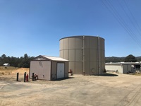
With temperatures rising and climate change increasing drought conditions in California, a project funded by DWR provided critical fire-fighting support to the Mariposa community by strengthening local water supply infrastructure as they battled one of the largest wildfires of 2022.
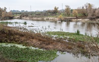
On a small scale, aquifers — subsurface natural basins — have been recharged with flood waters from extreme storms for decades. . Now, a new DWR assessment shows how Flood Managed Aquifer Recharge, or Flood-MAR, can help reduce flood risk and boost groundwater supplies across large areas of land.

With California in the third year of a severe drought and facing continued extreme weather swings, DWR has been developing and using new data and forecasting tools to better anticipate and manage available water supplies.

Lake Oroville Community Update for April 22, 2022.

DWR is working to reduce flood risks for more than a half million people in the Sacramento region as part of the first multi-benefit flood management and habitat project under the Central Valley Flood Protection Plan.
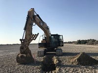
Last week a fleet of bulldozers and other heavy equipment began the enormous task of moving roughly 5 million cubic yards of soil around a 4,110-acre area of dry lakebed at the southern end of the Salton Sea as part of the Species Conservation Habitat Project.
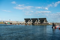
By experimenting with how salty ocean water mixes with fresh water within the Suisun Marsh, the Department of Water Resources (DWR) has found a way to improve habitat conditions for endangered delta smelt within the upper San Francisco Estuary.


